Ocean Inlet Park Reef
Other · Boynton Beach
26° 32.585' N 80° 02.509' W
 Open Water Max 12 ft Avg 8 ft Beach Access, 330 ft from shore
Today AMPoor
Details
Open Water
Minimum recommended certification
- Max depth
- 12 ft
- Average depth
- 8 ft
- Access
- Beach Access (330 ft from shore)
- Sea state today
- AMPoor PMPoor
Video
🎥 Sin, Florida, Sink!
Pictures 3
Where it is
26° 32.585' N 80° 02.509' W
Next boats to this site 0
No confirmed trips to this site are listed yet.
Best Gas


Gas prices
| Diluent tank | $35.50 |
| O2 tank | $10.00 |
atm
atm


Gas prices
| Aluminum 80 | $10 |
| Steel HP 100 | $10 |
| Steel LP 85 | $10 |
NDL at is
24 hr min surface interval
Always use a dive computer
Site description
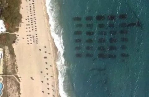
The Ocean Ridge Mitigation Reef is an artificial reef located approximately 260 feet (80 meters) south of the Boynton Inlet. It consists of a line of rock piles extending nearly 0.45 miles (0.7 kilometers) from the inlet to the beach in front of a condominium development. The reef was created by deploying 9,200 tons of rock and 160 tons of concrete modules in 2009 and 2010. Its purpose is to offset the impact on natural reef habitat caused by nearby shoreline stabilization efforts.
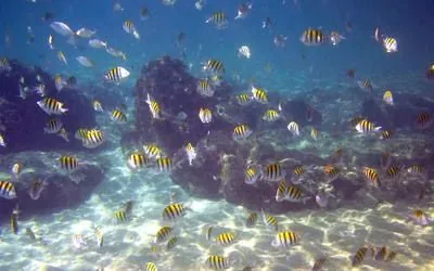
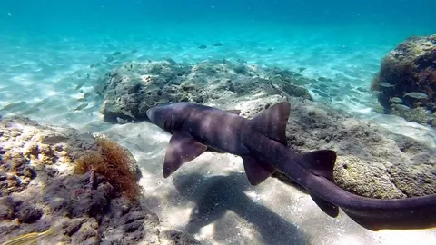
This snorkeler- and diver-friendly reef serves as a habitat for various reef fish species. Snorkelers and divers can encounter juvenile reef fish, as well as adults associated with back reef areas. Common sightings include doctorfish, sergeant majors, bar jacks, and damselfish species. Wrasses, grunts, and juvenile parrotfish also thrive in the complex habitat created by the rock piles.
While coral cover is limited in shallow habitats like this, colorful encrusting corals and stinging fire coral can still be observed. The rocky structures are covered in macroalgae and turf algae, providing food and shelter for herbivorous species. The reef sits on a sandy seafloor at a depth of just 14 feet (4 meters), making it easily accessible for snorkelers. Keep in mind that visibility near the beach may be poor during high surf conditions, but it generally improves as swimmers move farther from the shore
Route & typical conditions
Route
Snorkelers and divers usually enter the water south of the lifeguard tower, near the large sand discharge pipe that emerges from the beach. This location helps avoid the busy boat traffic near Boynton Inlet and reduces the risk of overshooting the artificial reefs.
Due to heavy boat traffic, it’s crucial for snorkelers and divers to carry a dive flag while in the water. This ensures visibility and safety.
After entering, swimmers cover approximately 400 feet (120 meters) to reach the artificial reefs. These submerged structures await exploration.
Most snorkelers choose to head south once they’ve reached the reefs. Here, they can explore the bulk of the reef system, encountering various marine life.
After finishing their exploration, divers and snorkelers can exit the water anywhere along the beach.
Typical conditions
Surface conditions may affect this dive. Always check conditions and plan for high tide - where water is rising and clean streams come from the ocean.
Divers' uploaded pictures
No diver pictures yet.