

USS Rankin
Wreck · Stuart also known as rankin
27° 11.332' N 80° 01.431' W
 Technical Air Max 140 ft Avg 100 ft Hot Drop
Today AMPoor
Details
Technical Air
Minimum recommended certification
- Max depth
- 140 ft
- Average depth
- 100 ft
- Access
- Hot Drop
- Sea state today
- AMPoor PMPoor
Video
🎥 ISDC
Pictures 2
Where it is
27° 11.332' N 80° 01.431' W
Next boats to this site 0
No confirmed trips to this site are listed yet.
Operators that dive here

Best Gas


Gas prices
| Diluent tank | $35.50 |
| O2 tank | $10.00 |
atm
atm


Gas prices
| Aluminum 80 | $10 |
| Steel HP 100 | $10 |
| Steel LP 85 | $10 |
NDL at is
24 hr min surface interval
Always use a dive computer
Wreck Details
Sunk July 24th, 1988
Cargo Ship
459 ftLength
63 ftBeam
Site description
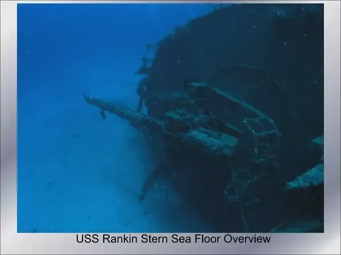
On the 24th of July, 1988, the U.S.S. Rankin found its final resting place beneath the waves, serving as an artificial reef roughly seven miles eastward of St. Lucie Inlet and positioned 13 nautical miles to the south of its counterpart, the U.S.S. Muliphen. Initially, the vessel settled on its starboard side, leaving its portside elevated about 70 feet from the ocean’s surface. Come 2004, the wrath of Hurricanes Frances and Jeanne wrought havoc upon the vessel, severing it into two distinct halves and inflicting severe damage to the bow. However, the stern section stood resilient and unscathed. Despite the structural compromises inflicted by these natural forces, the altered state of the Rankin has seemingly become a sanctuary, attracting a diverse array of marine life. The U.S.S. Rankin’s shallower location, in comparison to the deeper, offshore position of the U.S.S. Muliphen, typically results in reduced visibility.
Route & typical conditions
Route
Divers may need more than one dive to visit this site. Given it's depth, most times this dive is advertised as a technical dive - otherwise bottom time is very short for recreational divers.
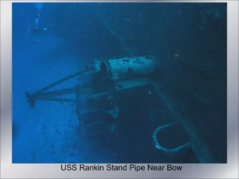
The Rankin is mostly broken apart, and very little of the old structures are intact. Divers should follow the wreck line. Penetration opportunities are very limited. Divers should apply extra care as the whole wreck structure suffered significant damage and it's very weak.
Typical conditions
Visibility tends to be low in this site - divers should expect 30 to 40 feet visibility in a good day, and as low as 10 feet in most occasions. This wreck sits in relatively deep waters and fairly north in south Florida - divers should plan for colder waters compared to diving in the Florida keys the same time of the year. Currents are typically very mild if any at all.
Wreck history

The USS Rankin, a Tolland-class attack cargo ship later reclassified as a Rankin class amphibious cargo ship, boasts a storied history. Named after Rankin County, Mississippi, the vessel was designed to carry military cargo and landing craft, deploying weapons, supplies, and troops onto hostile shores. During the tense days of the Cuban Missile Crisis in October 1962, the USS Rankin was deployed into Cuban waters, playing a crucial role in the United States’ naval operations1.
After serving valiantly for decades, the USS Rankin was repurposed as an artificial reef on July 24, 1988. She was deliberately sunk six miles off the coast of Stuart, Florida, and now lies on her starboard side at a depth of 130 feet2. This transformation into a dive site has not only preserved the vessel’s legacy but also created a thriving marine habitat.
The dive site of the USS Rankin is a testament to the ship’s enduring legacy and the transformative power of nature. It serves as a historical underwater museum, a haven for marine life, and a unique adventure for divers who visit the Florida coast to explore its depths. The USS Rankin continues to captivate those who dive its waters, offering a glimpse into the past and a sanctuary for the present.
Divers' uploaded pictures
No diver pictures yet.