Mariner 2 Tug
Wreck · Pompano Beach also known as mary st. phillip,mary st phillip
26° 13.948' N 80° 03.807' W
 Advanced Open Water Max 125 ft Avg 110 ft Hot Drop
Today AMPoor
Details
Advanced Open Water
Minimum recommended certification
- Max depth
- 125 ft
- Average depth
- 110 ft
- Access
- Hot Drop
- Sea state today
- AMPoor PMPoor
Pictures 6
Where it is
26° 13.948' N 80° 03.807' W
Next boats to this site 0
No confirmed trips to this site are listed yet.
Operators that dive here


Best Gas


Gas prices
| Diluent tank | $35.50 |
| O2 tank | $10.00 |
atm
atm


Gas prices
| Aluminum 80 | $10 |
| Steel HP 100 | $10 |
| Steel LP 85 | $10 |
NDL at is
24 hr min surface interval
Always use a dive computer
Wreck Details
Sunk May 1st, 1993
Tugboat
110 ftLength
28 ftBeam
Site description
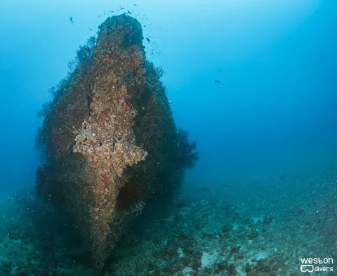
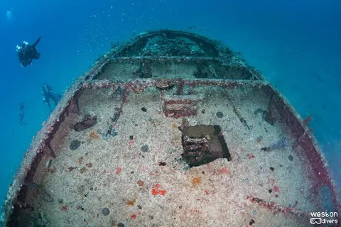
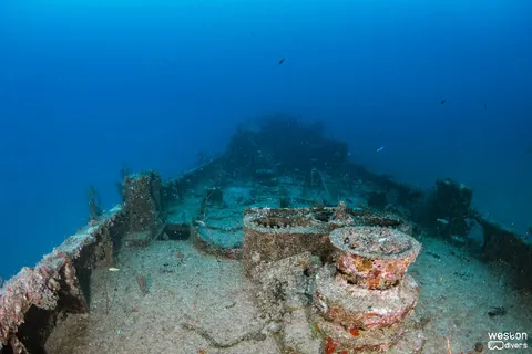
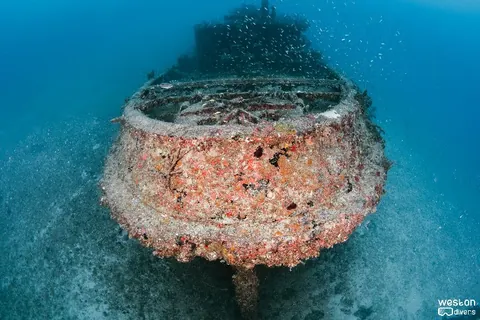
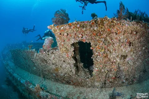
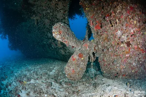
The Mariner II artificial reef site off Broward County comprises the tug Mary St. Phillip and a 120-foot-long barge. Locally, they are known as the Mariner II Tug and Mariner II Barge. The Mariner II Tug rests approximately 400 feet to the north of the Rodeo 25 wreck, while the Mariner II Barge is situated 800 feet south of the Mariner II Tug and lies just offshore from the freighter Union Express. These wrecks provide interesting dive opportunities, especially if you’re into underwater photography and exploring marine life.
It also challenge divers on their navigation skills as reaching from the tug to the barge may be easier said than done.
Lastly, the swim from the Rodeo to this site is known for having the presence of Bull Sharks - if you have a camera make sure it's ready!
Route & typical conditions
Route
It's very unlikely that operators will schedule trips to this site as the main attractions - given the proximity of Lady Luck and Rodeo 25; those tend to steal the headlines.
Still, this small but beautiful wreck is a few minutes away (swimming) from both of the above. From Rodeo 25 take a north heading (slightly east, maybe 10 degrees and you'll find this tug). Once there, divers should check on the surrounding and the interior of the wreck, There are plenty of picture opportunities in this wreck.
Typical conditions
Conditions vary in this site, but divers report fairly good conditions - current and visibility wise.
Wreck history

The tugboat LT-6 was launched in December 1943 by the Jakobson Shipyard in Oyster Bay, New York. Originally built for the U.S. Army, its service record remains unclear. However, it likely played a role during World War II, similar to its sister ships like LT-5, which participated in “Operation Mulberry.” This operation involved constructing artificial harbors during the D-Day invasion of Normandy, France, as part of “Operation Overlord.”
As for its name history, LT-6 has been known by various names, including Major Ocea L. Ferris, Captain Eric J. Newman, Falcon, and Mary St. Phillip.
Regarding its divesite, the tug Mary St. Phillip and a 120-foot-long barge form the Mariner II artificial reef site off Broward County. Locally, they are referred to as the Mariner II Tug and Mariner II Barge. The Mariner II Tug lies approximately 400 feet north of the Rodeo 25 and 800 feet south of the Mariner II Barge, which is situated just offshore of the freighter Union Express.
Divers' uploaded pictures
No diver pictures yet.